Maps
Maps can display the location of cameras, camera views, digital inputs and output devices, links, and labels in the Senstar Symphony Client interface.
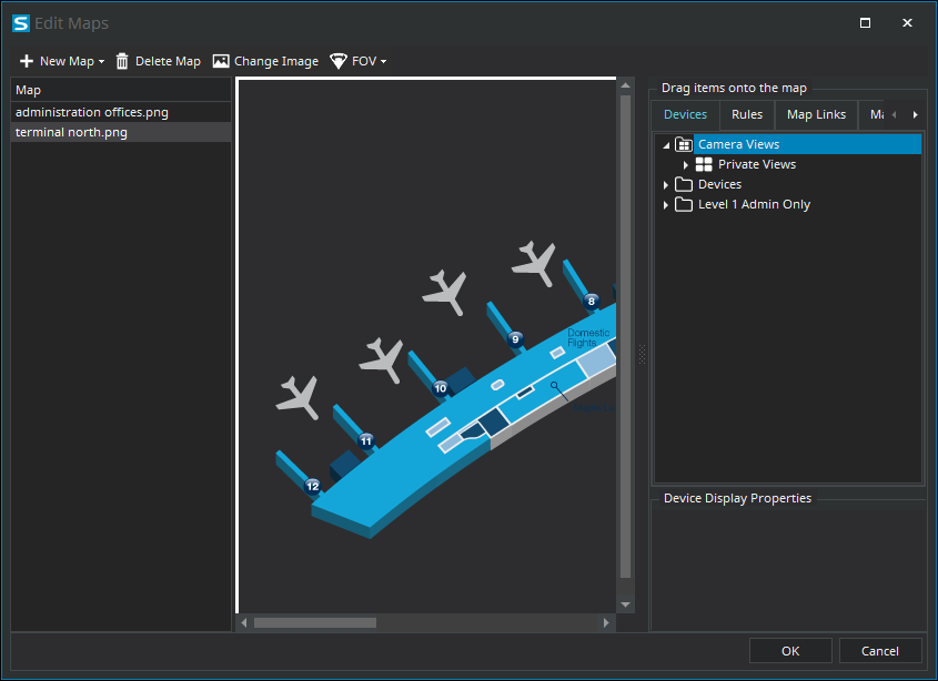
Map Editor
The Map Editor is a component in the Senstar Symphony Client that you use to manage maps.
You can use the Map Editor to add maps to the Senstar Symphony Client. A map can be an image file (jpg, gif, or bmp file), a CAD file (DWG 2013 format or earlier), or a map provided by a GIS service.
You can use the Map Editor to add cameras, camera views, digital inputs and output devices, links, and labels to a map. Items that you add to a map appear in and can add functionality to the map pane in the Senstar Symphony Client interface.
Map navigation
When you turn on map navigation, the Senstar Symphony Client interface displays the map pane.
- Clicking a camera icon displays the camera view in the active video panel.
- Clicking a camera view icon loads the camera view in the Senstar Symphony Client interface.
- Right-clicking an output device opens a context menu with commands that you can send to the device.
